Postnummer 2071 - Killara, New South Wales
| Primære by | Killara |
| Område for Postnummer 2071 | 7.8 km² |
| Befolkning | 13,539 |
| Mandlig befolkning | 6,477 (47.8%) |
| Kvindelig befolkning | 7,062 (52.2%) |
| Befolkningsændring fra 1975 til 2015 | +72.8% |
| Befolkningsændring fra 2000 til 2015 | +24.9% |
| Middelalder | 41.3 år |
| Mandlig middelalder | 40.4 år |
| Kvindelig middelalder | 42.2 år |
| Forbundne byer | Gordon |
| Nabolag | Ku-ring-gai |
| Timezone | Australian Eastern Standard Time |
| Koordinater | -33.762890266946926° / 151.1669207176161° |
| Relaterede Postnumre | 2061, 2062, 2070, 2072, 2073, 2074, 2075, 2076, 2077, 2079 |
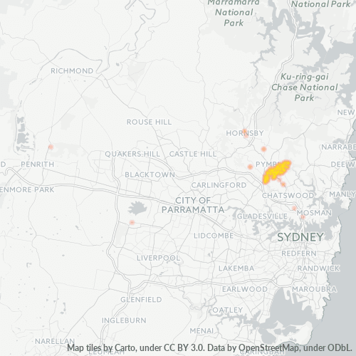
Kort over Postnummer 2071 - Killara, New South Wales
Interaktivt kort
Postnummer 2071 - Killara, New South Wales befolkning
År 1975 til 2020
| Data | 1975 | 1990 | 2000 | 2015 | 2020 |
|---|---|---|---|---|---|
| Befolkning | 7.834 | 9.657 | 10.844 | 13.539 | 14.488 |
| Befolkningstæthed | 1.005,2 / km² | 1.239,2 / km² | 1.391,5 / km² | 1.737,3 / km² | 1.859,1 / km² |
Postnummer 2071 - Killara, New South Wales befolkningsændring fra 2000 til 2015
Stigning på 24.9% fra år 2000 til 2015
| Beliggenhed | Ændring siden 1975 | Ændring siden 1990 | Ændring siden 2000 |
|---|---|---|---|
| Postnummer 2071 - Killara, New South Wales | +72.8% | +40.2% | +24.9% |
| New South Wales | +72.6% | +40.2% | +25.4% |
| Australien | +72.6% | +40.3% | +25.5% |
Postnummer 2071 - Killara, New South Wales medianalder
Medianalder: 41.3 år
| Beliggenhed | Middelalder | Median alder (kvinde) | Median alder (mand) |
|---|---|---|---|
| Postnummer 2071 - Killara, New South Wales | 41.3 yrs | 42.2 yrs | 40.4 yrs |
| New South Wales | 38.3 yrs | 39.2 yrs | 37.4 yrs |
| Australien | 37.7 yrs | 38.6 yrs | 36.8 yrs |
Postnummer 2071 befolkningstæthed
Befolkningstæthed: 1.737 / km²
| Beliggenhed | Befolkning | Areal | Tæthed |
|---|---|---|---|
| Postnummer 2071 | 13.539 | 7,8 km² | 1.737 / km² |
| New South Wales | 8,1 million | 801.634,1 km² | 10,1 / km² |
| Australien | 23,8 million | 7.690.961,5 km² | 3,1 / km² |
Postnummer 2071 - Killara, New South Wales historisk og forventet befolkning
Estimeret befolkning fra 1870 til 2100
- JRC (European Commission's Joint Research Centre) arbejde på GHS built-up grid
- CIESIN (Center for International Earth Science Information Network)
- [Link] Klein Goldewijk, K., Beusen, A., Doelman, J., and Stehfest, E.: Anthropogenic land use estimates for the Holocene – HYDE 3.2, Earth Syst. Sci. Data, 9, 927–953, https://doi.org/10.5194/essd-9-927-2017, 2017.
Områdenumre
Procentdel af områdekoder anvendt af virksomheder i Postnummer 2071 - Killara, New South Wales
Industries
Virksomhedsfordeling efter branche i Postnummer 2071 - Killara, New South Wales
| Industribeskrivelse | Antal virksomheder | Gennemsnitlig alder for erhvervslivet |
|---|---|---|
| Advokater og juridisk | 14 | — |
| Arkitekter | 13 | — |
| Bilværksteder | 15 | — |
| Bogholdere | 20 | — |
| Børne- og dagpleje | 12 | — |
| Ejendomme | 27 | — |
| Elektronikhandlere | 15 | — |
| Indkøb | 33 | — |
| Kreativ kunst | 16 | — |
| Offentlige parker | 23 | — |
| Opførelse af bygninger | 35 | — |
| Reklamer og annoncering | 12 | — |
| Restauranter | 24 | — |
| Sundhed og medicinsk | 58 | — |
| Tekniske konstruktionstjenester | 16 | — |
| Undervisning | 14 | — |
| Virksomhedsledelse | 37 | 19.3 year |
Virksomhedsfordeling efter pris for Postnummer 2071 - Killara, New South Wales
Human Development Index (HDI)
Statistisk sammensat indeks over forventet levealder, uddannelse og indkomst pr. Indbygger.
Postnummer 2071 CO2-udledning
Kuldioxid (CO2) -emissioner pr. Indbygger i ton pr. År
| Beliggenhed | CO2-udledning | CO2-emissioner pr. Indbygger | CO2-emissioner Intensitet |
|---|---|---|---|
| Postnummer 2071 | 268,125 tn | 19.8 tn | 34,405.2 tons/km² |
| New South Wales | 140,286,593 tn | 17.39 tn | 175 tons/km² |
| Australien | 401,155,564 tn | 16.88 tn | 52.2 tons/km² |
| 2013 CO2-udledning (tons/år) | 268,125 tn |
| 2013 CO2-udledning (tons/år) per indbygger | 19.8 tn |
| 2013 CO2-udledningsintensitet (tons/km²/år) | 34,405.2 tons/km² |
Naturlige farer
Relativ risiko ud af 10
| Fare | Risikoniveau |
|---|---|
| Tørke | Mellem (4) |
| Flood | Høj (8) |
| Jordskælv | Mellem (4) |
Nylige jordskælv i nærheden
Størrelse 3.0 og større
| Dato▼ | Tid↕ | Magnitude↕ | Distance↕ | Dybde↕ | Beliggenhed↕ | Link |
|---|---|---|---|---|---|---|
| 9/9/12 | 11:23 PM | 3.2 | 71.8 km | 2,000 m | near the southeast coast of Australia | usgs.gov |
| 8/17/07 | 8:57 PM | 3.2 | 100 km | 18,000 m | near the southeast coast of Australia | usgs.gov |
| 4/10/07 | 5:58 PM | 3.1 | 56.3 km | 20,000 m | near the southeast coast of Australia | usgs.gov |
| 10/31/05 | 10:13 AM | 3.1 | 94.1 km | — | near the southeast coast of Australia | usgs.gov |
| 2/14/02 | 5:27 AM | 3.9 | 88.2 km | 10,000 m | near the southeast coast of Australia | usgs.gov |
| 3/16/99 | 5:58 PM | 3.8 | 68 km | 10,000 m | near the southeast coast of Australia | usgs.gov |
| 8/6/94 | 4:03 AM | 5.3 | 89.7 km | 10,000 m | near the southeast coast of Australia | usgs.gov |
| 12/27/89 | 3:26 PM | 5.4 | 97.8 km | 10,000 m | near the southeast coast of Australia | usgs.gov |
| 6/24/87 | 7:53 AM | 3.1 | 49.6 km | 33,000 m | near the southeast coast of Australia | usgs.gov |
| 6/24/87 | 8:47 AM | 3.5 | 97.9 km | 10,000 m | near the southeast coast of Australia | usgs.gov |
Byer
Procentdel af virksomheder efter by i Postnummer 2071 - Killara, New South Wales
Om vores data
Dataene på denne side er estimeret ved hjælp af en række offentligt tilgængelige værktøjer og ressourcer. Det er leveret uden garanti og kan indeholde unøjagtigheder. Brug på eget ansvar.